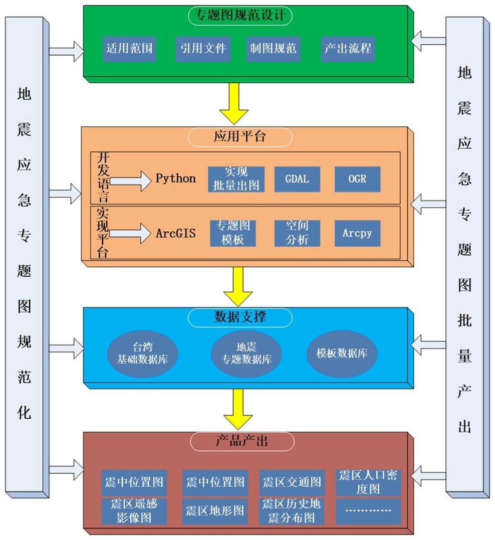
ArcGIS是地理信息领域的领航者,拥有强大的空间分析和数据制图功能[12]。ArcGIS的ArcPy是一个Python站点包,可提供以实用高效的方式通Python执行地理数据分析、数据转换、数据管理和自动化出图。本文主要探讨设计台海地震应急专题图规范,并将该规范通过python的二次开发应用到ArcGIS平台上实现地震应急专题图的标准化,自动化产出。下图是本文的技术框架图。分专题图规范,应用平台,数据支撑,产品产出四个部分。
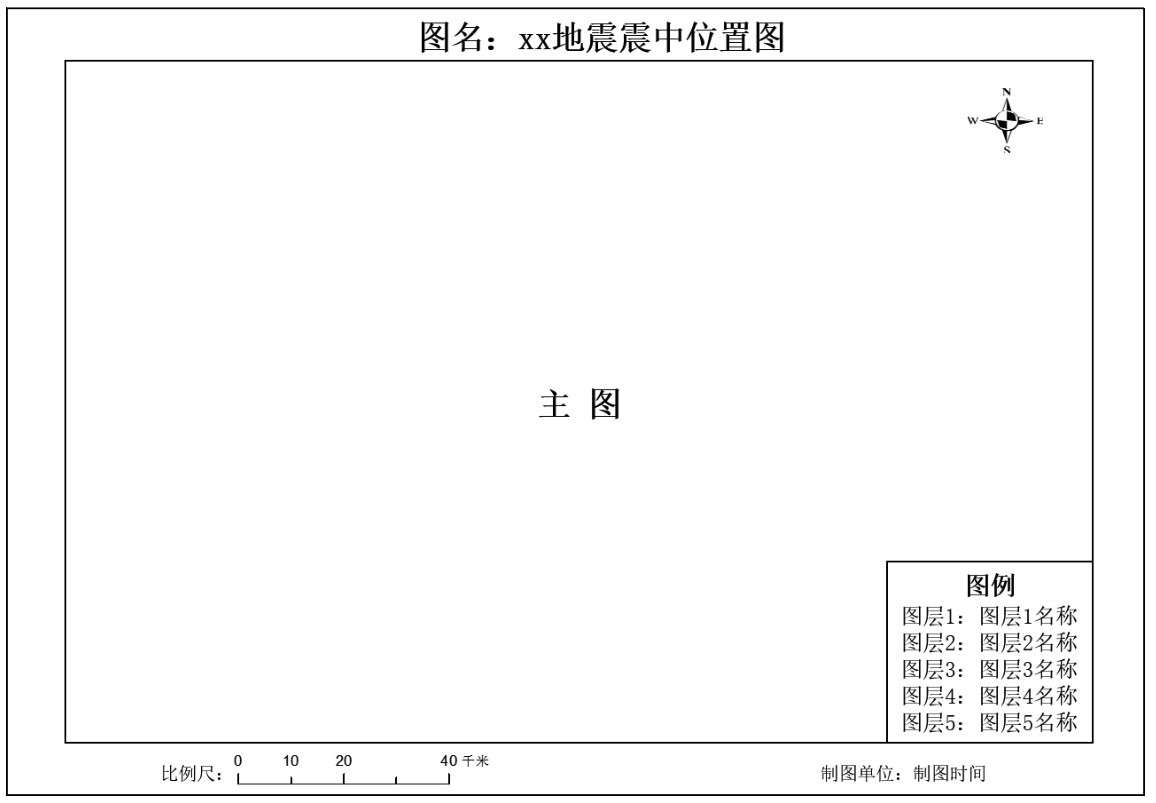
图1 专题图空间布局图Fig.1 Spatial layout of thematic map
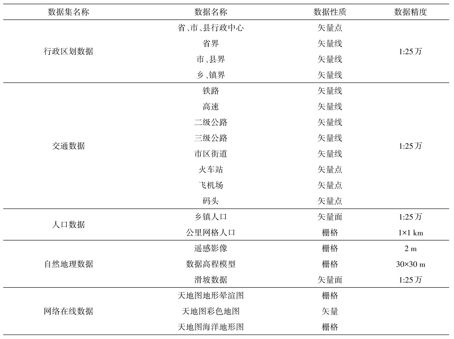
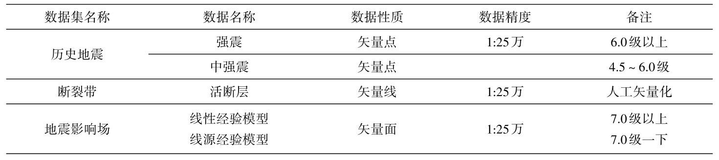
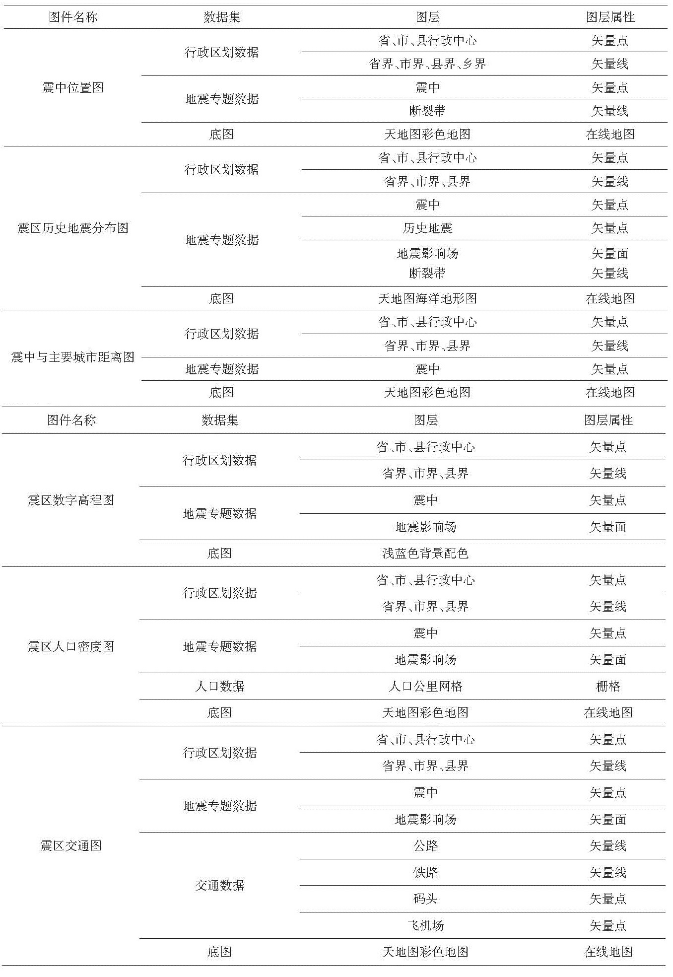
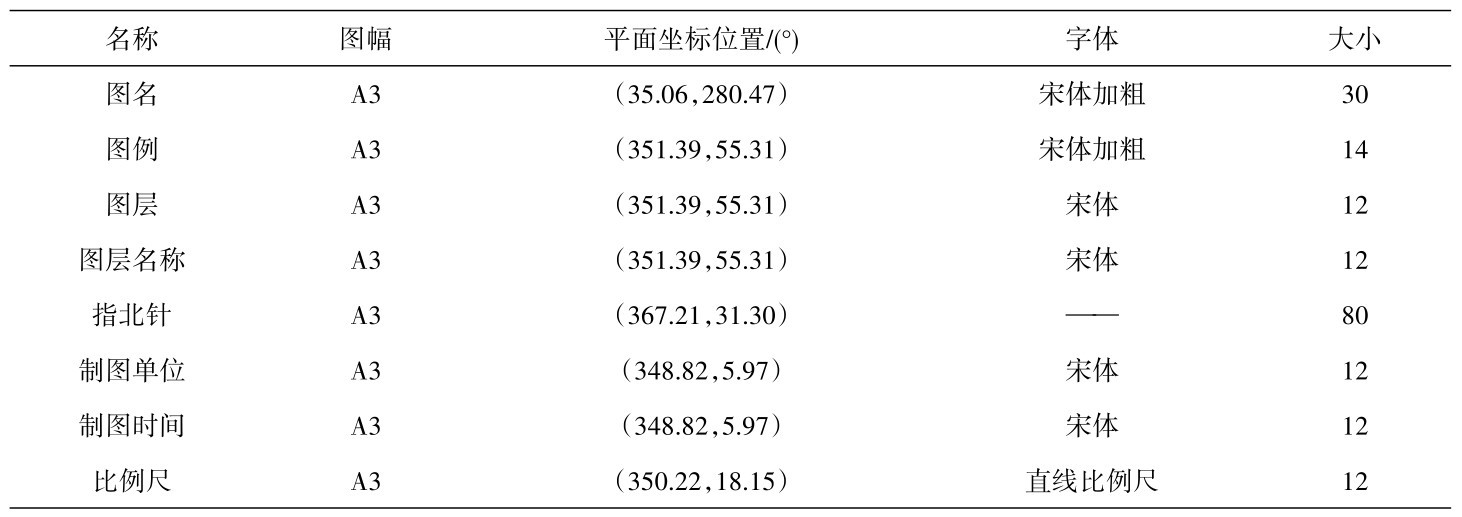
表8 专题图要素空间布局表Table 8 Spatial layout table of thematic map elements
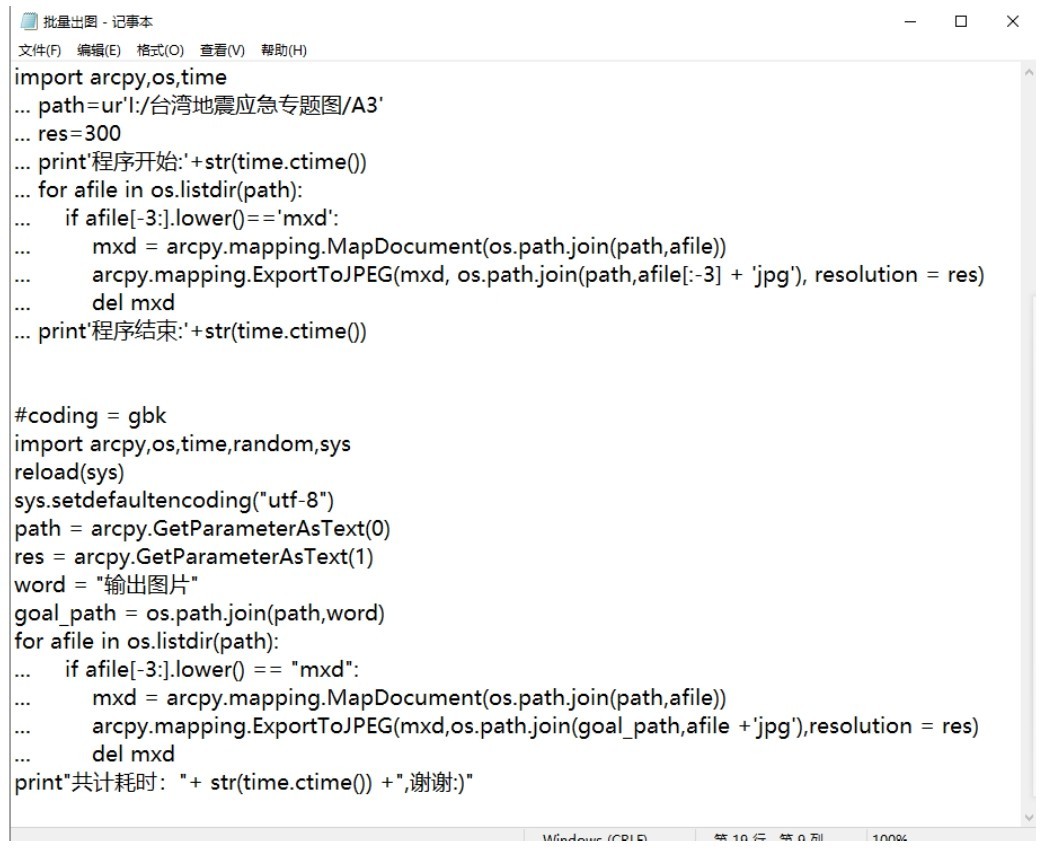
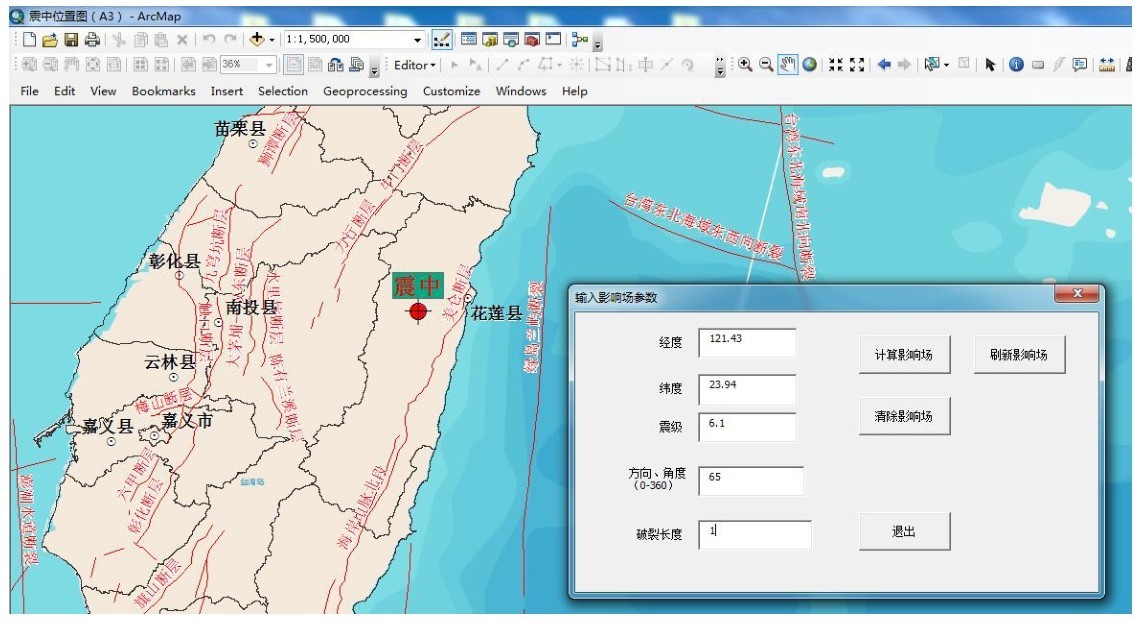
图3是通过Python语言在ArcGIS平台上进行二次开发的部分代码;图4是软件的关于地震三要素的输入界面。
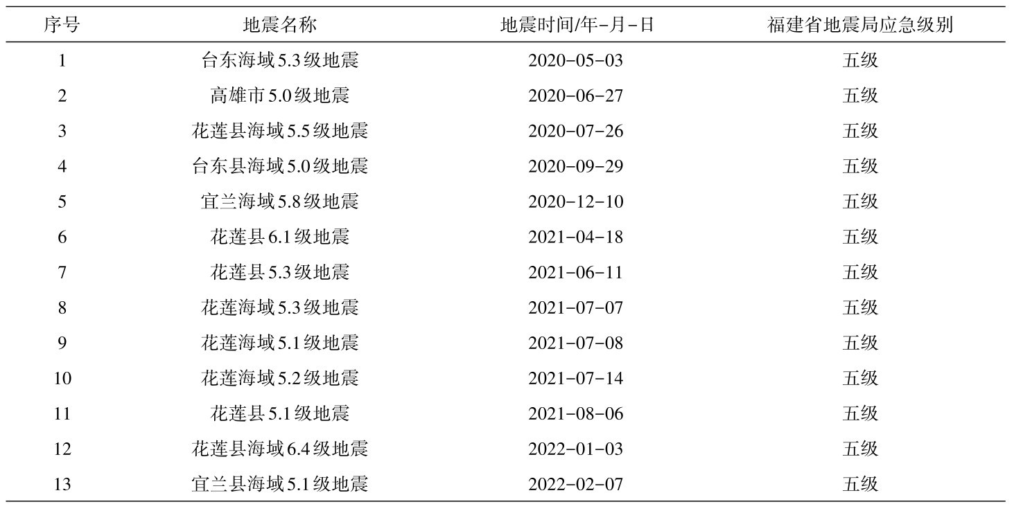
福建省地震局根据中国地震局的有关要求,结合台湾地区地震频繁的实际情况,拟定了《福建省地震局地震应急响应工作方案》。根据该项方案要求,台湾东海岸30 km范围内,地震级别达到5.0级,福建省地震局就需要启动应急响应工作。自2020年以来,福建省地震局关于台湾地区的地震启动了13次五级地震应急响应。
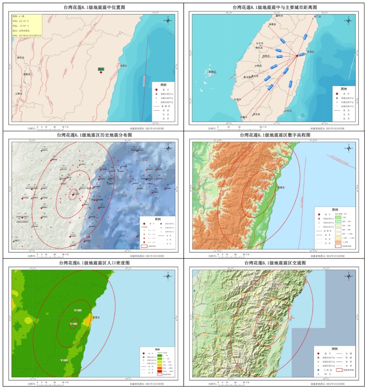
图5是采用该规范设计的,通过基于python的ArcGIS二次开发自动产出的台湾地震应急响应的产出图件。
通过该规范设计实施,目前在应对台湾地震应急方面初步实现了标准化、自动化出图,很大程度上提高了应急响应效率。同时初步建立了台湾省地震应急基础数据库,满足应对台湾破坏性地震需要,为地震应急响应工作开展提供可靠的数据与图件保障。
图2 技术框架图Fig.2 Technical framework diagram
图3 部分代码截图Fig.3 Screenshot of part of the code
图4 地震三要素输入界面Fig.4 Input interface of three elements of earthquake
图5 台湾地震应急产出图件Fig.5 Emergency output map of Taiwan earthquake
表9 福建省地震局关于台湾地震的应急响应列表Table 9 Emergency response list of Taiwan earthquake by Fujian Earthquake Agency