收稿日期:2024-04-30
基金项目:湖南省地震局防震减灾攻关科研课题:长沙地区房屋地震易损性研究(202401)
资助作者简介:邵磊(1984-),男,工程师,主要从事地震危险性分析、场地地震影响评价等工作。E-mail:79541207@qq.com
通信作者:盛强(1984-),男,高级工程师,主要从事地震构造、工程地质、地震危险性分析等研究。E-mail:269267018@qq.com
基金项目:湖南省地震局防震减灾攻关科研课题:长沙地区房屋地震易损性研究(202401)
资助作者简介:邵磊(1984-),男,工程师,主要从事地震危险性分析、场地地震影响评价等工作。E-mail:79541207@qq.com
通信作者:盛强(1984-),男,高级工程师,主要从事地震构造、工程地质、地震危险性分析等研究。E-mail:269267018@qq.com
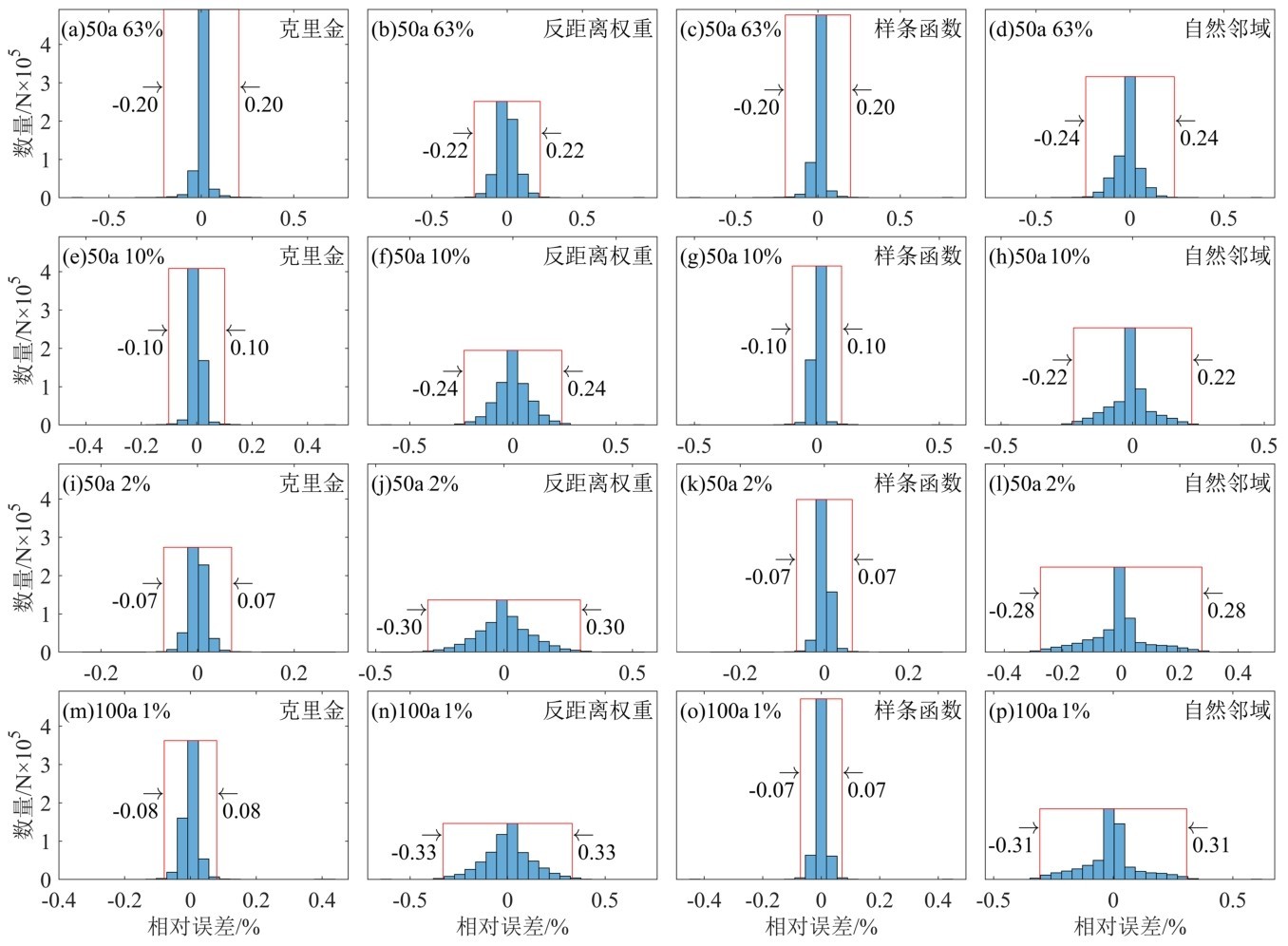
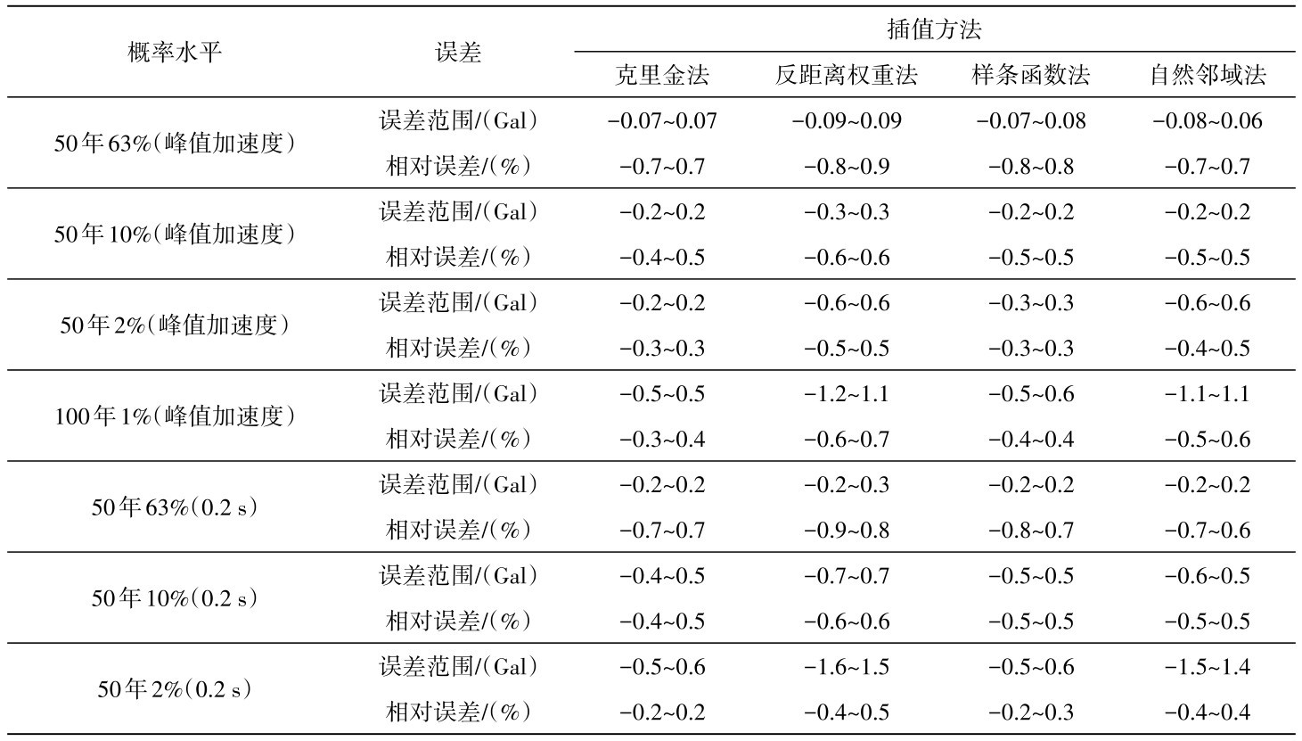
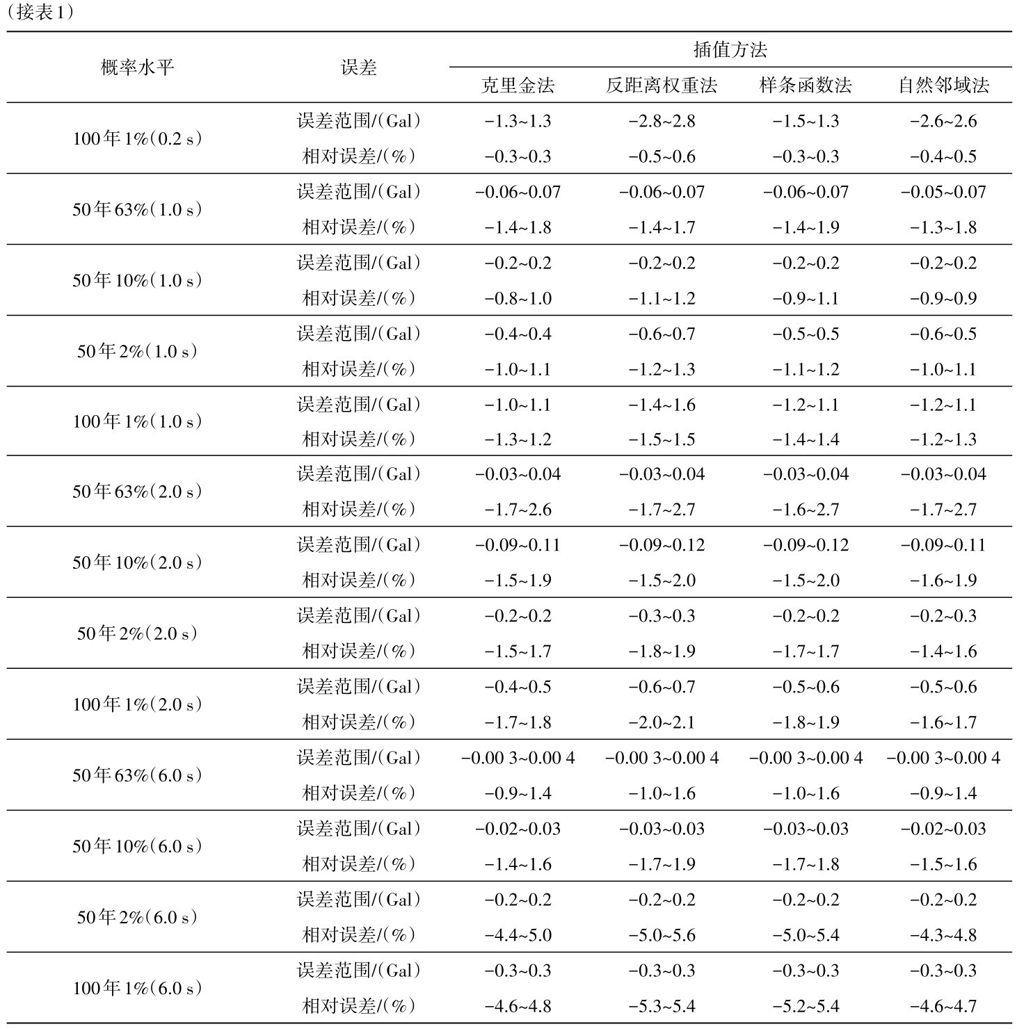
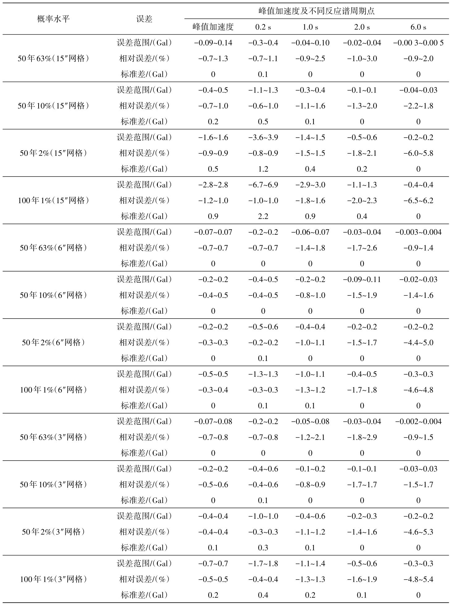
 之间,除极少数外均小于五代图不低于
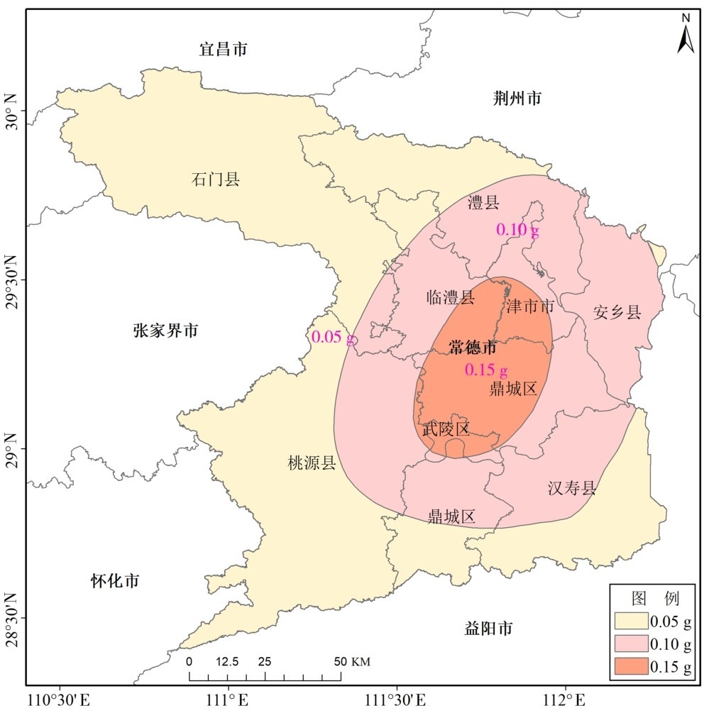
 的要求,整体上低于湖北省的研究成果[9];罕遇地震动(50年2%)与基本地震动的峰值加速度之比介于1.6~2.6,除常德地区局部略偏高外,均满足五代
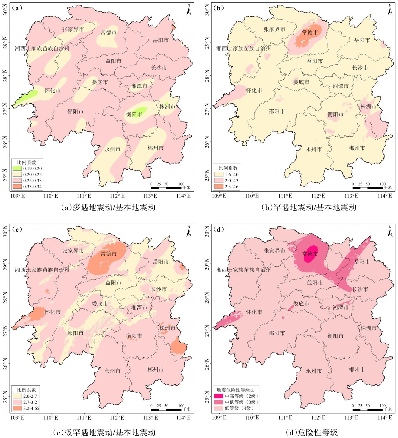
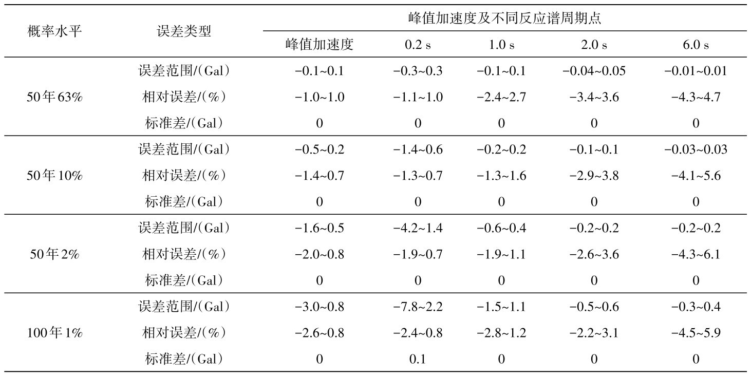
 ,罕遇地震动与基本地震动的峰值加速度之比与五代图结果基本一致,全省超过
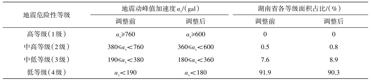
 面积的极罕遇地震与基本地震动的峰值加速度之比低于2.7,极罕遇地震在一定范围可能被低估。地震危险性分级结果表明,湖南省危险性等级最高为中高等级(2级),少数为中低等级(2级),绝大部分为低等级(4级)。