收稿日期:2021-09-10
基金项目:广东省国土资源保护与治理专项资金(2017201)
作者简介:卢进延(1985-),男,工程师,主要从事物化探勘查研究工作。E-mail:123706158@qq.com
基金项目:广东省国土资源保护与治理专项资金(2017201)
作者简介:卢进延(1985-),男,工程师,主要从事物化探勘查研究工作。E-mail:123706158@qq.com
DOI: 10.13512/j.hndz.2021.04.01
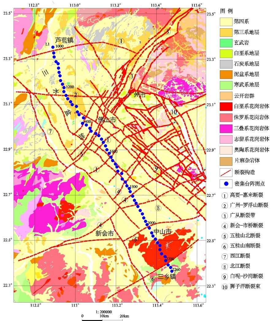
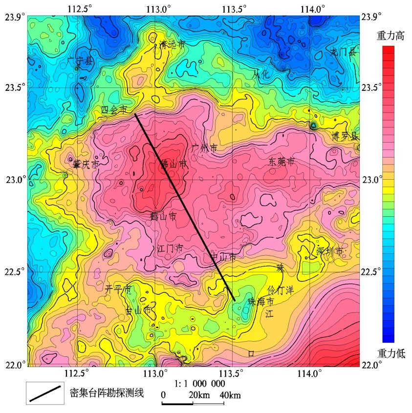
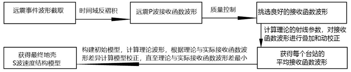
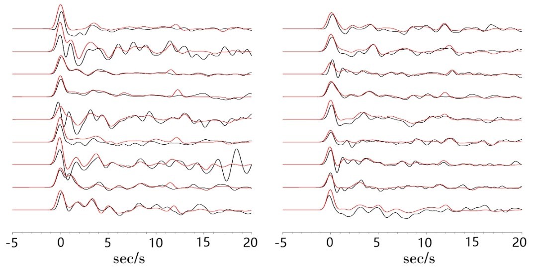
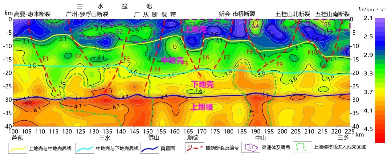
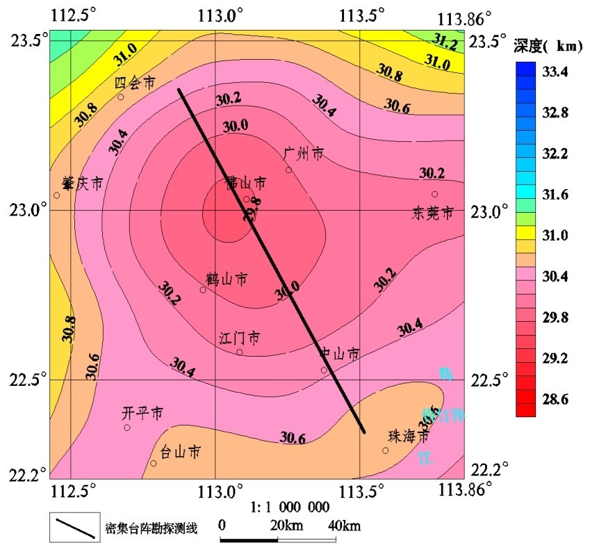
为了研究珠江三角洲核心地区中深部地壳结构,在芦苞—佛山—中山—三乡地区开展了密集台阵勘探工作,使用接收函数方法处理反演,获得珠江三角洲核心地区40km以浅Vs速度结构。结合研究区的地质、重力异常特征对反演成果分析获得初步成果:珠江三角洲地区地壳结构可分为上地壳、中地壳、下地壳和上地幔四个大层位,上地壳厚度在临海一侧变厚,在中山三乡镇一带,厚达14km;莫霍面隆起、上地幔物质侵入下地壳和高密度岩浆侵入上地壳这个三个因素共同导致研究区重力异常高;获得了沿线中深部断裂构造空间展布特征信息,速度结构和断裂构造具有较好的相关性;沿测线地壳在15~20km深的深度上不存在低速层;三水盆地基底深度在3km左右,与该地区沉积层厚度一致;莫霍面深度北深南浅,深度在27.5~30km之间,其波速特征明显,由3.6km/s突变为4.1km/s。
In order to study the middle-deep crustal structure in the core area of the Pearl River Delta,intensive array exploration was carried out in the Lubao-Foshan-Zhongshan-Sanxiang area. The receiver function method is used to process the inversion,and the shallow Vs velocity structure of the core area of the Pearl River Delta at 40 km is obtained. The article combines the geological and gravity anomaly characteristics of the study area to analyze the inversion results and obtain preliminary results: the crustal structure of the Pearl River Delta region can be divided into four layers:the upper crust,the middle crust,the lower crust and the upper mantle. The thickness of the upper crust thickens on the side near the sea and reaches 14 km in Sanxiang area of Zhongshan. The Moho uplift,the intrusion of upper mantle material into the lower crust and the intrusion of high density magma into the upper crust lead to the abnormally high gravity in the study area. The spatial distribution characteristics of mid-deep fault structures along the line are obtained. The velocity structure has a good correlation with fault structures. There is no low-velocity layer in the crust at the depth of 15-20 km along the survey line. The basement depth of Sanshui Basin is about 3 km, which is consistent with the thickness of the sedimentary layer in this area. The Moho depth is deep in the north and shallow in the south with depth between 27.5-30 km, and its wave velocity features are obvious,which changes from 3.6 km/s to 4.1 km/s.