收稿日期:2021-06-30
基金项目:中国地震局地震工程与工程振动重点实验室重点专项(2019EEEVL0102)
作者简介:张露露(1993-),助理工程师,主要从事地震应急遥感应用技术研究。 E-mail:2462338704@qq.com
基金项目:中国地震局地震工程与工程振动重点实验室重点专项(2019EEEVL0102)
作者简介:张露露(1993-),助理工程师,主要从事地震应急遥感应用技术研究。 E-mail:2462338704@qq.com
 的计算公式如下:
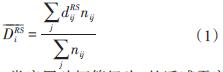
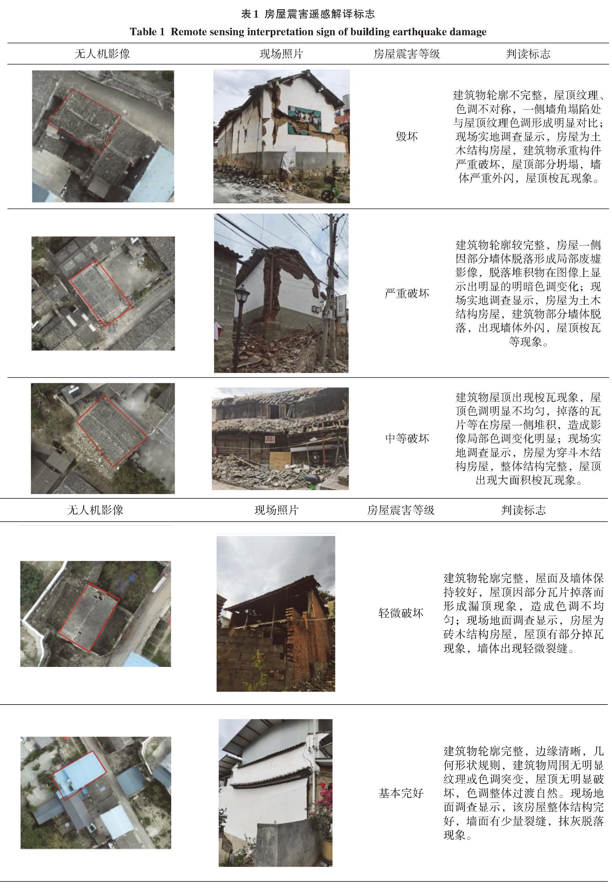
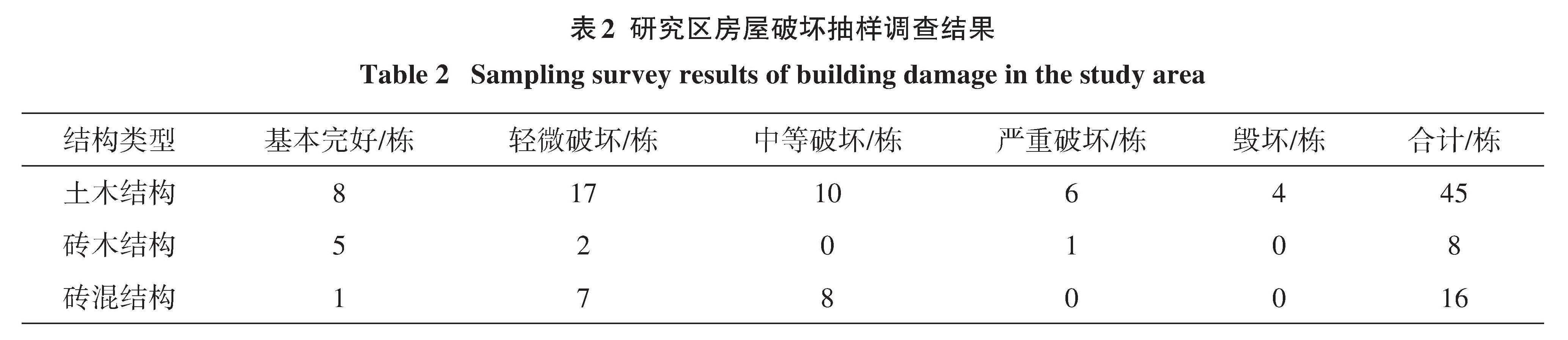
 表示i类房屋破坏等级为j的遥感震害指数,nij为i类房屋破坏等级为j的房屋栋数或建筑将房屋破坏等级j划分为3级(1-倒塌;2-局部倒塌;3-未倒塌),为将房屋破坏等级j更好的与现场调查结果对比,本文将遥感评估中的破坏等级划分为与地面调查等级一致的5个等级,即1-毁坏、2-严重破坏、3-中等破坏、4-轻微破坏、5-基本完好。